
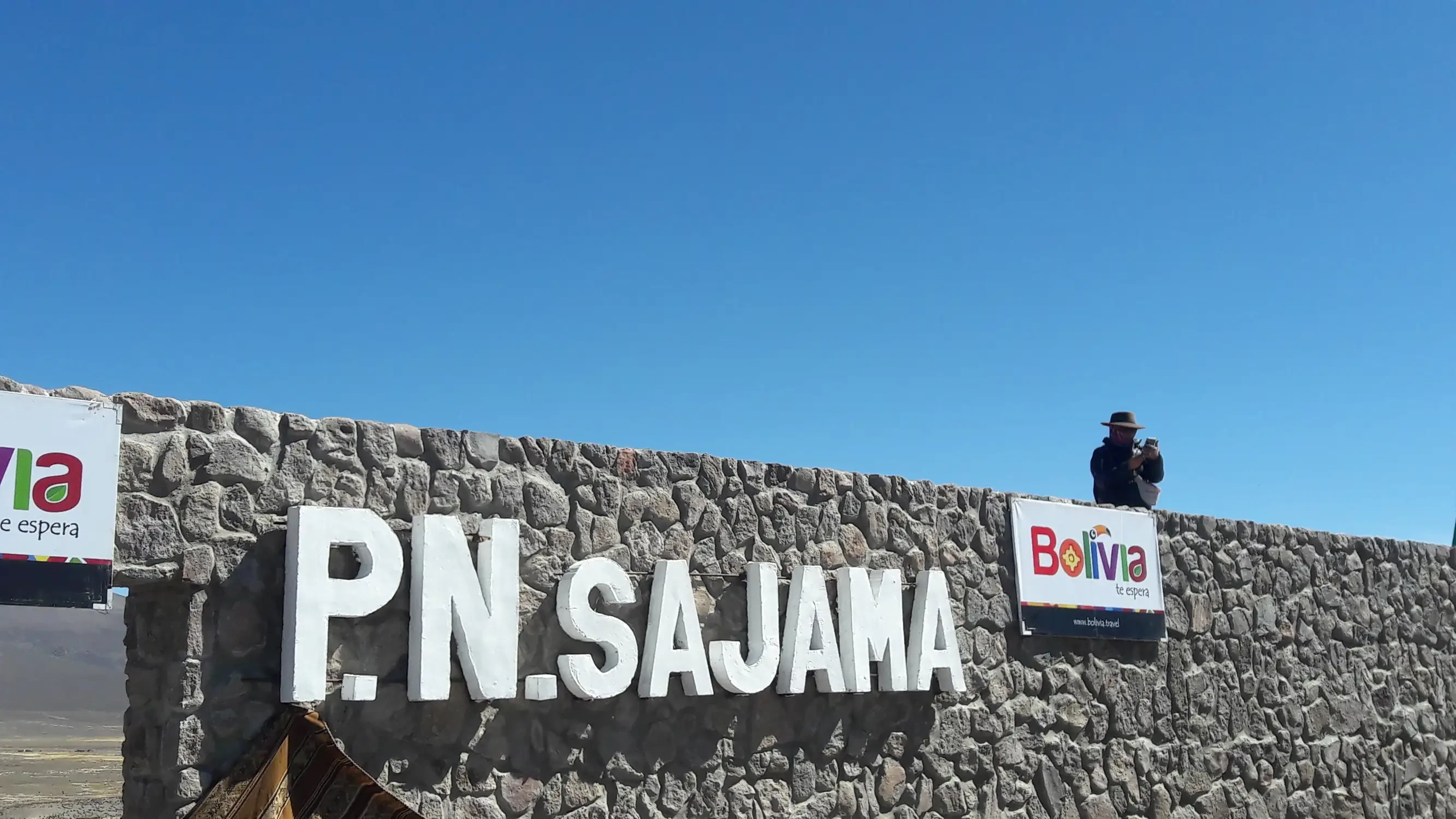
Travel Information for Visiting Sajama National Park
Sajama National Park
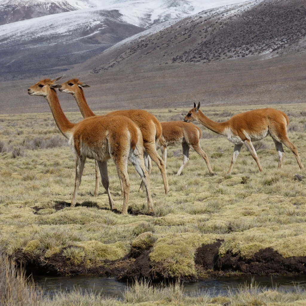
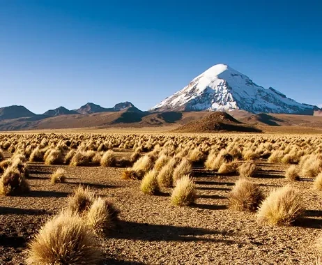
Sajama National Park is the first Protected Area created in Bolivia, characterized by its small queñua forests (Polylepis tarapacana) that cover more than 10,000 hectares and rise above 5,200 m a.s.l., constituting the highest woody formation in the world. Also notable are the yareta fields of Azorella compacta, extensive peatlands and moist grasslands, and tholares of Parastrephia lepidophylla. Another relevant aspect is the presence of threatened fauna species such as the vicuña.
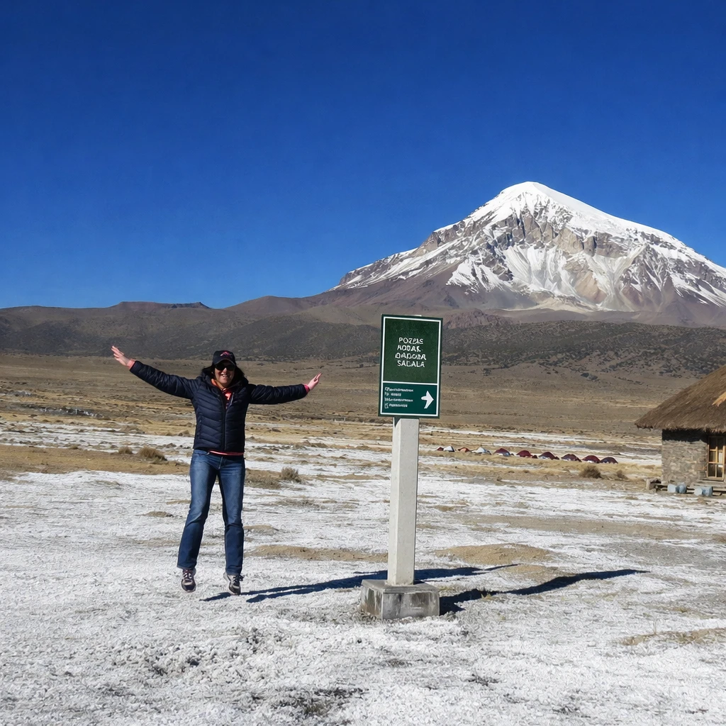
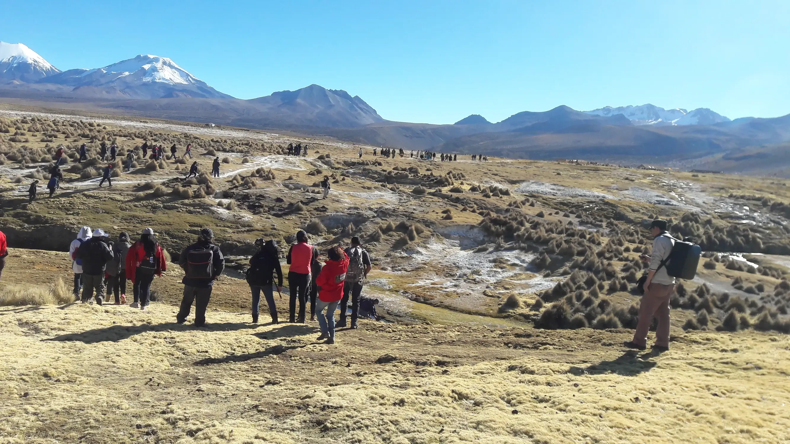
The Area has exceptional scenic beauty due to the presence of the imposing Nevado Sajama, high‑Andean lagoons, hot springs, and mountaineering routes. Likewise, within the Park and in its immediate surroundings are archaeological and historical sites of great cultural value, such as the Chullpas, pictographs, pre‑Columbian ruins, and colonial churches, such as that of Curahuara de Carangas.
Tourist Attractions
Data
Management Category
National Park.
Extension
The estimated area is 100,230 ha (1,002 km²).
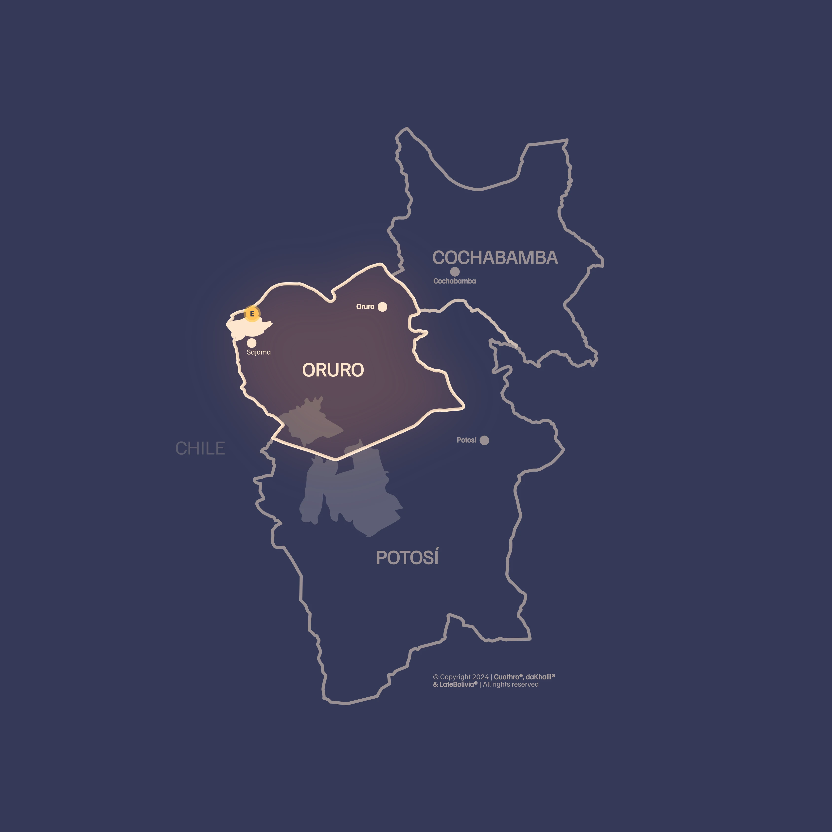
Location
Sajama National Park is located in the northwest of the Oruro Department, in the Sajama Province. The municipalities involved are Turco and Curahuara de Carangas; it borders the La Paz Department and the frontier with Chile (Lauca National Park).
Biogeographical Subregions, Altitudinal Range and Climate
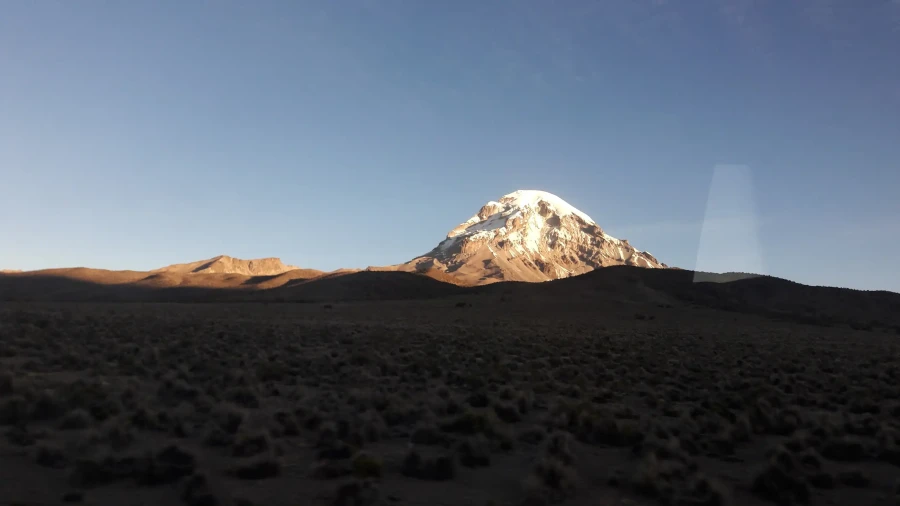
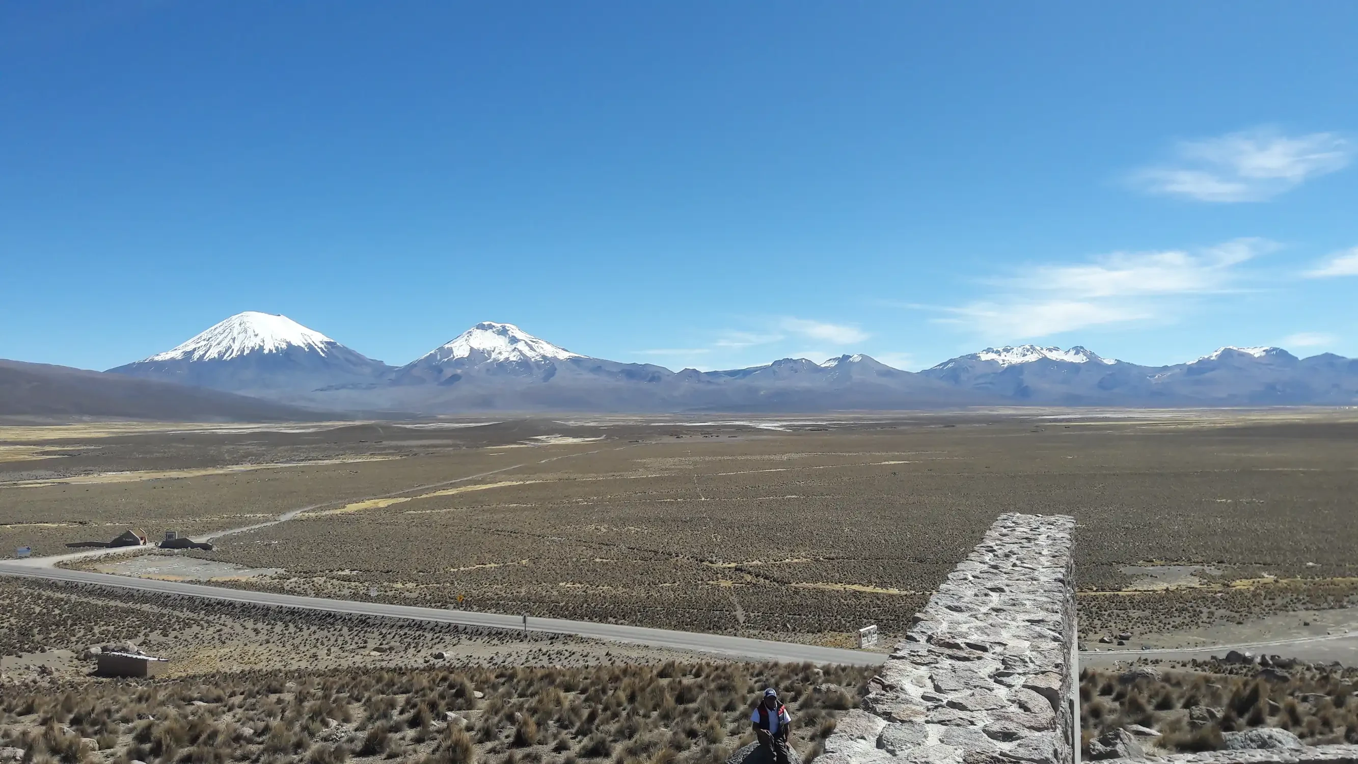
It corresponds to the Puna; the altitudinal range varies between 4,000 and 6,542 m a.s.l., the region of the Western or Volcanic Mountain Range, characterized by its extensive high plateaus, high‑Andean lagoons and imposing volcanic cones such as the Payachatas and Nevado Sajama, which constitutes the highest point in Bolivia. The climate is cold to freezing, with summer rains and frost throughout the year.
How to Get to Sajama National Park from La Paz?
From the city of La Paz, you can reach Sajama National Park by passing through Patacamaya and following the road toward Tambo Quemado, the border with Chile, which allows access to Lauca National Park and subsequently to Arica. Buses can be taken from La Paz heading to Arica and Iquique, or directly from Patacamaya. On this route, it is recommended to visit the town of Curahuara de Carangas to admire its church. Visitors departing from Oruro can take the road toward the town of Turco to continue toward Cosapa. In this case, it is recommended to enter with your own vehicle.
Sajama
Sajama National Park is located in the northwest of Oruro, bordering the department of La Paz and the Chilean frontier. Nevado Sajama is a neighbor to Lauca National Park in Chile and the Stone City in the La Paz department; it is easily accessible via an international highway, the Patacamaya – Tambo Quemado road. From La Paz, you can reach Sajama by passing through Patacamaya and then heading toward Tambo Quemado. Along this route lies the town of Curahuara de Carangas, home to a church well worth admiring, known as "The Sistine Chapel of the Altiplano."
The climate is cold to freezing, with summer rains and frost throughout the year. The region is markedly arid, with annual precipitation levels fluctuating between 270 and 400 mm.
Wildlife
108 fauna species have been recorded in Sajama National Park. Among these, the vicuña (Vicugna vicugna), the armadillo (Chaetophractus nationi), the Andean cat or titi (Felis jacobita), the puma (Felis concolor), the suri (Pterocnemia pennata), the condor (Vultur gryphus), the chocka (Fulica gigantea), the parihuano (Phoenicopterus chilensis), and small birds such as Asthenes arequipae, Oreomanes fraseri, and Phrygilus erythronotus stand out.
Vegetation and Flora
154 plant species have been recorded, and the existence of approximately 250 higher plant species is estimated. The vegetation of the High Andean floor presents hard and silicified grasses. Peatlands cover 10% of Sajama National Park and constitute the vegetation unit of greatest socio-environmental importance. In the tree and shrub flora, the populations of queñua (Polylepis tarapacana), the tholares associated with grasslands (Parastrephia lepidophylla, P. lucida, Baccharis incarum), and yareta (Azorella compacta) are relevant.
Tourism
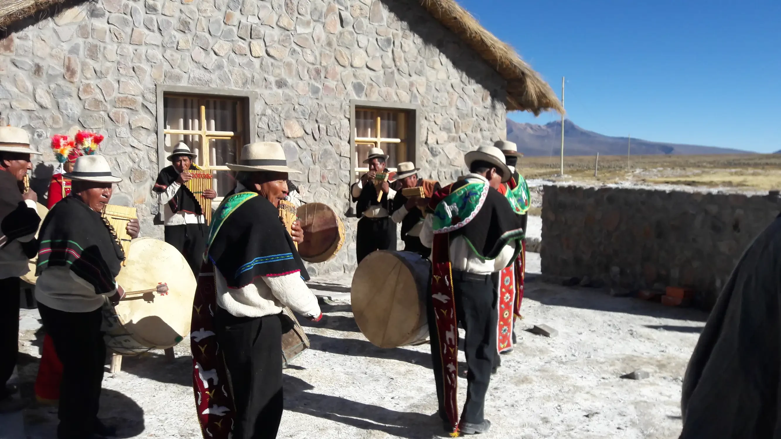
Its scenic beauty is unparalleled due to the presence of the imposing Nevado Sajama, high‑Andean lagoons, hot springs, and mountaineering routes, and it is also characterized by its queñua woodlands that cover more than 10,000 ha up to 5,200 m a.s.l., constituting the highest woody formation in the world. Sajama National Park also houses archaeological and historical sites of great cultural value such as the Chullpas, pictographs, pre‑Columbian ruins in the "Río Lauca" Circuit, and colonial churches, such as that of Curahuara de Carangas. The tourist flow for carrying out ecotourism and mountaineering activities has enabled the Tomarapi community to build an Eco‑Lodge with excellent accommodation and dining services.
Local Population
Human occupation in the area is millennia-old and the inhabitants, of Aymara origin, belong to the Karanga ethnic group. Currently, there are about 80 dispersed farms in the surroundings, which group 60% of the population living inside the Park. Within the proposed boundaries converge the cantons of: Curahuara de Carangas (Sajama, Caripe and Lagunas) and part of the Cosapa canton from the municipality of Turco. The total population is estimated at around 1,000 inhabitants.
Archaeological Sites
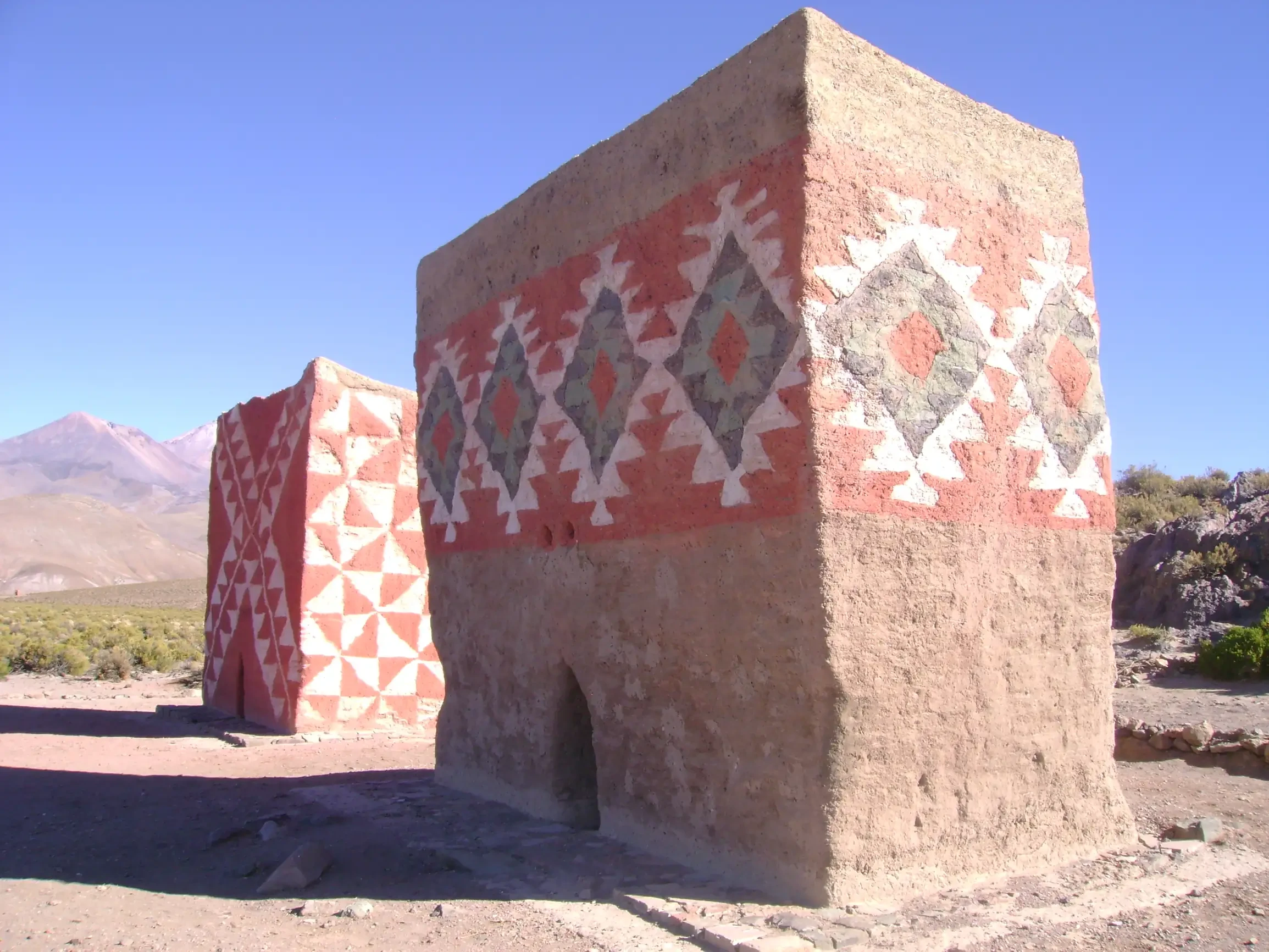
Within Sajama National Park several pre-Hispanic archaeological sites are concentrated that evidence the long Aymara occupation of the area. Among the most outstanding are the polychrome chullpas (funerary towers of fired clay brick decorated with geometric paintings) that are scattered throughout the valleys and slopes of the park, and a series of rock paintings of Andean style dating from the pre-Columbian era representing human figures, animals, and abstract motifs. Pucaras (stone fortresses) and remains of colonial-indigenous architecture have also been identified in ancient Aymara settlements, where traditional circular houses coexist with stone and adobe structures. These vestiges, along with the Sajama lines (alignments of stones and markings on the ground that form geometric patterns) and ceramic artifacts found in excavations, constitute a valuable record of the interaction between Aymara culture and the high mountain environment, and form part of the cultural heritage that complements the natural wealth of the park.
Tripadvisor
