
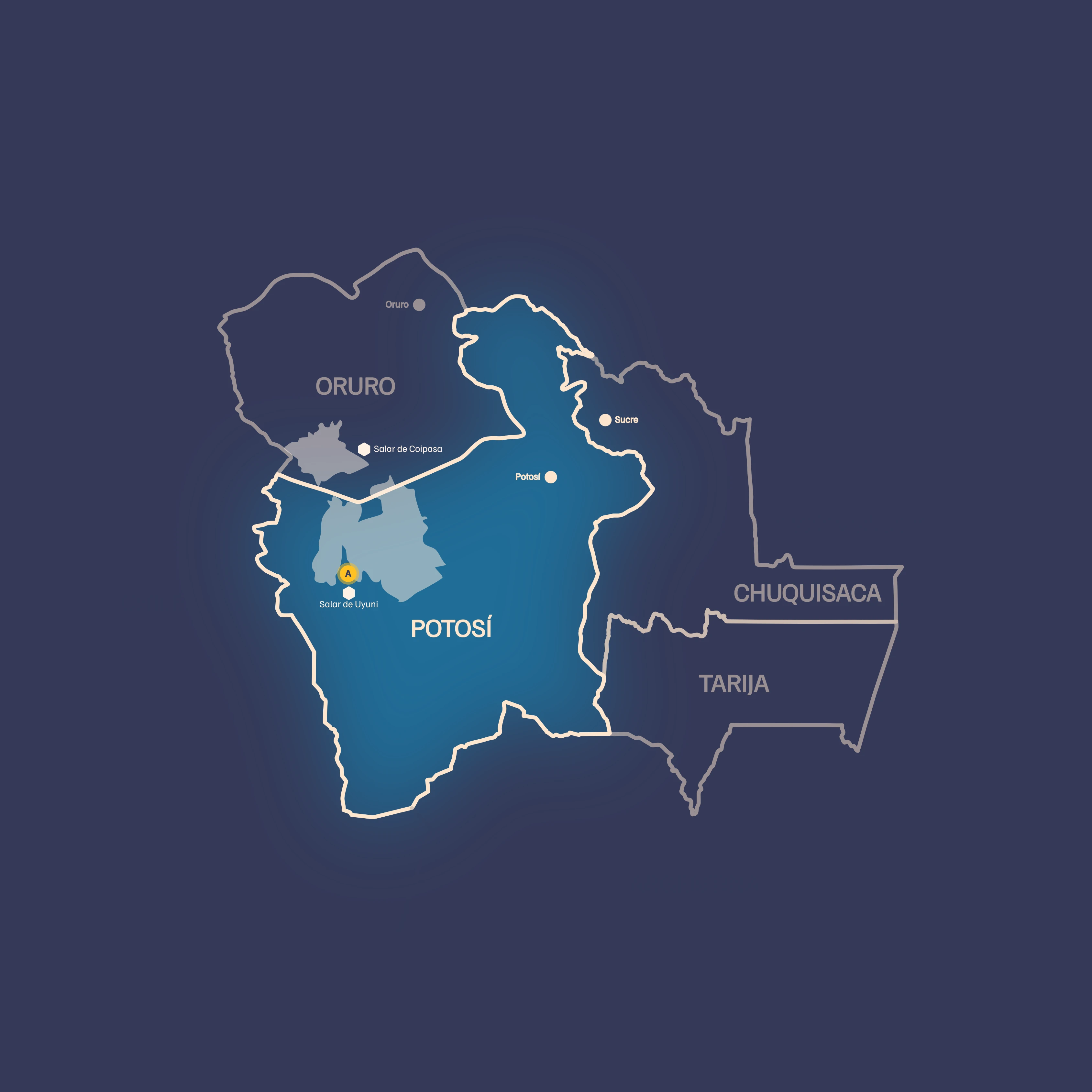
Circuit of the Uyuni Salt Flat, the Colored Lagoons and the Eduardo Avaroa Reserve
About Uyuni
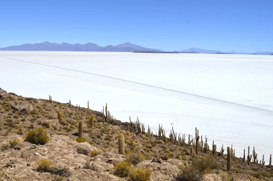
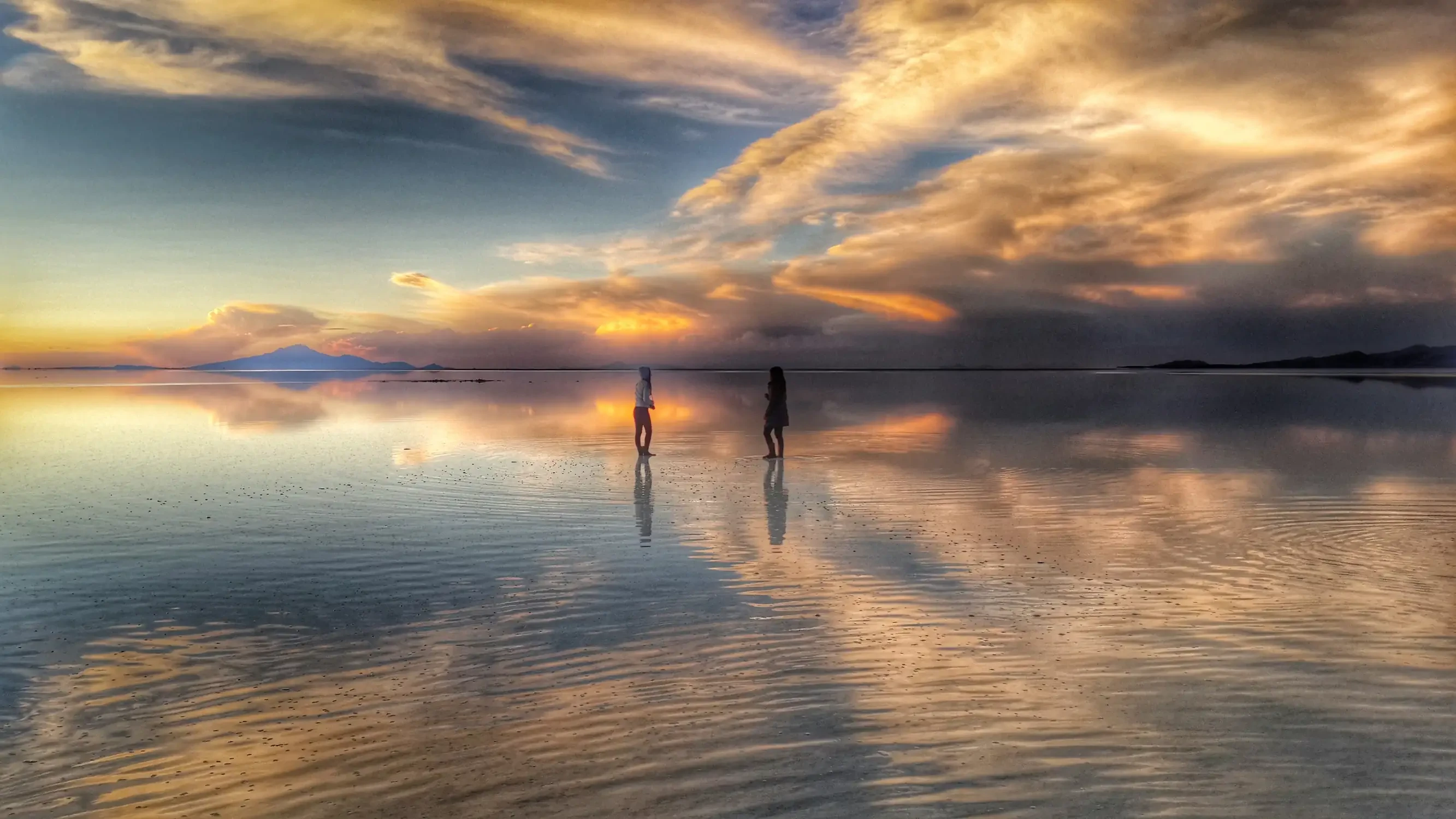
The Uyuni Salt Flat (also known as Tunupa) is surrounded by the Bolivian Altiplano and the Andes mountain range. It is the largest salt flat in the world, covering 12,000 km² and sitting at an altitude of 3,650 m above sea level.
Forty thousand years ago, the area now occupied by the Uyuni Salt Flat was covered by the prehistoric Lake Minchin. The salt depth varies from 10 cm to 8 m. The flat contains lithium, boron, potassium, magnesium, borax, sodium sulfates and ulexite, making it today the world’s largest lithium reserve.
Within the tourist circuit that visits the Uyuni Salt Flat, a stop at the Eduardo Avaroa Reserve (REA) is possible. The reserve hosts the famous colored lagoons, the most renowned being Laguna Colorada, which spans 60 km² and is only 35 cm deep. Inside the REA you can also explore the Siloli Desert with striking color combinations, the “Stone Forest,” the “Morning Sun” volcanic area with fumaroles and geysers. The Eduardo Avaroa Reserve also provides a crossing from Bolivia into Chile via the Hito Cajón border pass. From Laguna Verde, at the southern tip of the reserve, you can easily reach San Pedro de Atacama, enabling a scenic trek between the Bolivian Altiplano and the Chilean desert.
Laguna Colorada gets its name from the high concentration of sediments, pigments from certain algae, and minerals; its waters range from brown to intense red. South American flamingos breed in this lagoon.
The region also connects Bolivia with northern Argentina through the Lípez Deserts. A journey to the tourist town of Tupiza reveals surreal landscapes: colorful mountains, wind‑shaped rock formations, and the striking “Ciudad Roma,” a natural labyrinth of stone columns reminiscent of ancient ruins. From Tupiza you can take a four‑hour drive to the Bolivian‑Argentinian border at Villazón.
Discover the natural wonders
Coquesa: Mystical and magical
The town of Coquesa is 13 kilometers from Tahua, reached via a winding dirt road. The town is notable for housing, within its district, the mysteries of an archaeological site whose origins are unknown, although traditional archaeologists claim the tombs belong to the Chipaya Lordship.
What to do in Coquesa?
- Visit the mummy cave by hiking a steep trail that showcases the marvelous landscape of the Uyuni Salt Flat. Upon reaching the caves, the community tour guide invites visitors to enter the cave after a brief walk along a dirt path.
- From the mummy cave you can continue the ascent to the summit of Tunupa, reaching a viewpoint that offers a panoramic view of the Uyuni Salt Flat.
- Visit the Chantani museum: the museum includes an interpretive section on the Tunupa volcano and the Tahua area, as well as pottery and utensils found in archaeological sites.
Eduardo Avaroa Andean Fauna Reserve
How the visit begins is with the town of San Pedro de Quemes, a small community near the Uyuni Salt Flat that bears the scars of the Pacific War, something reflected in the visit to Pueblo Quemado, a site devastated by that conflict between Bolivia and Chile. It features Chullpas and archaeological sites, a viewpoint, rock paintings and petroglyphs, among other attractions.
The Eduardo Avaroa Reserve circuit complements the Uyuni Salt Flat circuit. The Eduardo Avaroa Reserve circuit perfectly extends the Uyuni Salt Flat visit, moving from the endless white salt landscapes to a volcanic environment filled with colorful lagoons, geysers, and wildlife. Together they form a complete tour of the natural diversity of the Bolivian Altiplano.
What does the circuit allow you to discover?
- The visual experience grows as you visit the “High‑Andean Jewels,” a group of lakes of great scenic value ideal for birdwatching: Laguna Cañapa, Laguna Hedionda, Laguna Chiarcota, Laguna Honda and the small Chalviri salt flat.
- Discover flora and fauna: “Paja brava” is abundant in this sector of the Altiplano. Areas where “queñua” and “yareta” thrive can also be found. Approximately 23 mammal species inhabit this zone.
- To complement this tourist circuit, in the southwestern Potosí region, we recommend visiting the projects of the Asociación Pueblos Mágicos de Lípez, which have established a café, an interpretation centre, and a cultural space in the community of San Cristóbal.
- For the arrival of foreign tourists from neighboring Argentina, we recommend an Information Centre located in the city of Villazón, where you can access important information about Bolivian culture and society as a whole.
Uyuni Salt Flat: General information
Geographic data
- Location: Southwest Bolivia, in Daniel Campos province, Potosí department, within the high‑plateau region of the Andes Mountains
- Elevation: 3 650 m above sea level (on the Uyuni Salt Flat and Colored Lagoons circuit you reach 4 300 m, at the foot of Licancabur Volcano)
- Average temperature: Winter 1 °C, Summer 13 °C (in winter temperatures can drop to –20 °C in the Lípez area)
How to get to Uyuni?
- Daily flights to Uyuni operate from La Paz, offered by BOA and Ecojet airlines.
- Overland access is possible via direct buses from La Paz, Potosí and Sucre.
Important information
- Uyuni and the Eduardo Avaroa Reserve are strategic points to continue your journey toward:
- San Pedro de Atacama (Chile)
- La Quiaca – Jujuy – Salta (Argentina)
- Potosí – Sucre – Tupiza (Bolivia)
Tripadvisor
