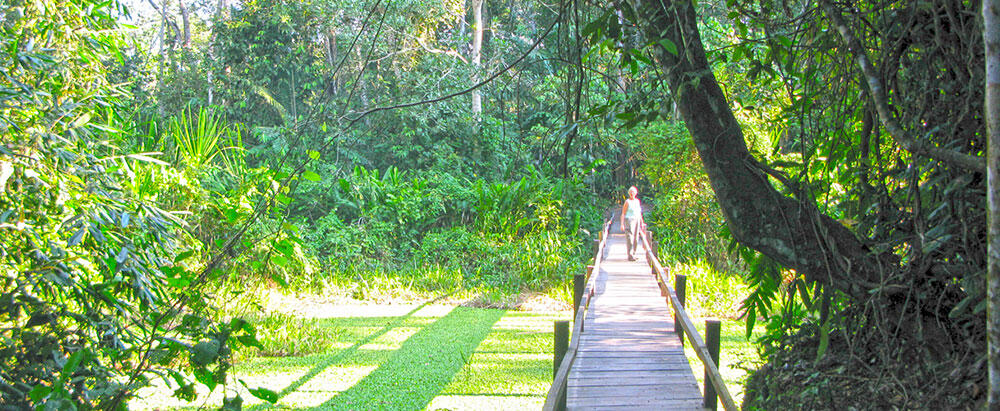
From Rurrenabaque only 45 by boat upriver, on the right bank is the community-owned lodge of San Miguel del Bala, the newest of the community-owned eco-tourism enterprises in the area.
This lodge’s advantage is its proximity to Rurrenabaque; it can even be visited if one goes to the area for the day, or if one can only stay for one overnight. Its offer is varied insofar as they relate to activities in the forest with emphasis on observation of wildlife: birds, monkeys, footprints of large mammals, plants and the option of spending time with the members of the San Miguel community, conditions that invite a longer stay.
In San Miguel del Bala one can walk through different jungle paths, engage in bird-watching, visit a gorgeous waterfall and share time with the San Miguel del Bala Community.
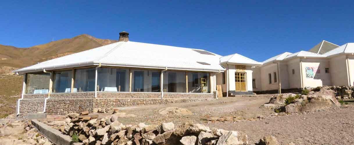
The lodge has seven cabins with private baths, hot showers and electric energy at night, as well as a couple of cabins with shared bathrooms. It offers an Interpretation Center where social activities, relaxation or seminars are held.
This Center has hammocks, board games and book about the Tacana culture. This is also where local handicrafts are shown and sold.
A big, comfortable cabin has been designed as kitchen and dining hall, whichserves not only the lodge’s guests, but also those visitors that come to San Miguel for the day. The lodge also has a camping area.
The San Miguel community has been the only one in the whole country that has requested being made a part of a protected area, in this case the Madidi, as due to its proximity it shares the fauna and flora characteristics of the Park’s interior, allowing their guides to provide services with a Tacana vision.
San Miguel del Bala offers five different programs that vary in price according to their duration and content for children, groups and special programs.
TAYKA HOTELS NETWORK
Though the area has been visited by tourists for about 30 years, hotel infrastructure was, until very recently, quite poor. This situation has changed in part thanks to private investment such as the Tayka Hotel Network that is a mixed-enterprise, that is that the hotels have been built in part with favorable low-interest loans. The communities where the hotels have been built have signed an agreement with the Foundation “Prodem” for it to manage the hotels for 15 years, and after then, management will pass entirely into the hands of the communities.
The three hotels working at present are the Hotel de Sal (Salt Hotel), the Hotel de Piedra (Stone Hotel) and the Hotel del Desierto (Desert Hotel). The first is in the northern side of the Salar in the Tahua locality, the second is further south, in the area of San Pedro de Quemes, and the third is on the edge of the Eduardo Avaroa Reserve, at about 40 km by car from Laguna Colorada, in a point called Ojo de Perdiz (Partridge’s eye) the first two rise to an altitude of 3.700 m.a.s.l., while the third rises to 4.600 m.a.s.l..
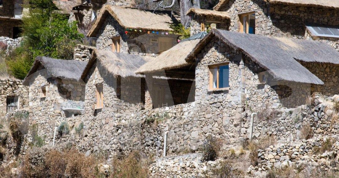
All three have comfortable rooms with private bath and hot water. The common areas are spacious and have been architecturally designed in harmony with the local aesthetic. The fist, following the Hotel de Sal model is made of salt blocks. The second has been built with lithic materials using construction techniques used by local colonial-period buildings. The three possibly share a defect – the spaces are too large and difficult to heat, especially in winter.
Staying in all three hotels is feasible, if, departing La Paz at dawn, one arrives early at the Tahua Salt Hotel. For this trip, one should use the route that departs Oruro toward Quillacas and there going toward Garci Mendoza, and then taking the road that borders the Thunupa volcano on its northern flank. The second day can be used to visit the Salar in its full magnificence, including the Inca Huasi Island and some of the attractions on the flanks of the Thunupa, for example the pre-Hispanic cemetery, or the so-called Galaxy Grotto, and stay overnight in the Desert Hotel to see Laguna Colorada, the geysers and Laguna Verde, continuing later to San Pedro of Atacama in Chile.
A trip through that area, either following the above-mentioned route or returning from Laguna Verde toward the north, must be done in a four-wheel-drive vehicle. In Uyuni there is a series of enterprises, small and large, that offer those services. Going through the area in one’s own car, without anyone who knows the place well is risky. Signs are scarce and a GPS does not help, especially as the choices to be made in crossings have no relation to direction but with the condition of one path or another with the condition of one path or another, where one can fall into traps such as water holes. Hiring local services is therefore recommended because of their experience and the mutual-help networks of those who live in the area.
UYUNI SALT FLATS AND EDUARDO AVAROA ANDEAN FAUNA NATIONAL RESERVE
With a surface that comes close to 10.000 km2 and located to in the southwestern part of Bolivia, the Uyuni Salt Flats, usually just called the “Salar”, are the largest in the world. It is estimated the Salar contains a strata of about six meters of common salt in a very pure state. At an altitude of 3.700 m.a.s.l., west of Uyuni, it stretches out like an enormous flat and white sheet of colossal dimensions. The shores of this white salt expanse have large bays, and are generally very swampy.
Enormous amounts of salt are worked, especially in the village of Colchani. First small salt hills are mounded for dehydration; then the salt is taken to town where it is dried and where iodine is added. All of this work is done manually by families.
One of the most visited spots in the Salar is the famous Inca Huasi Island, or Fish Island, thus called because it resembles a fish at a distance. In this promontory one can see a large and thick cactus forest.
RED LAGOON
Laguna Colorada or Red Lagoon, located in the Eduardo Avaroa National Andean Fauna Reserve, in the Potosi highlands near the chilean border. It has a 69 km2 long surface and is about 80 cm deep.
The red color of its water is due to certain algae and bacteria that change color with the temperature, and which become a deeper red with brighter sunlight, at times turning into a violet-red hue. Near the water there are borax hillocks that seem to float on the red waters.
This is possibly the place where the greatest concentration of flamingoes in South America nested.
How these birds can survive extreme nighttime temperatures reaching -20ºC and below is a mystery. At an altitude of 4.200 m.a.s.l., three different types of flamingos can be found in the lagoon. All cohabit near each other peaceably as their bills are shaped differently and thus each different species feeds on different types of algae.
DESERT OF LIPEZ
In Bolivia’s last nook, in the Los Lipez area, in front of the famous Laguna Verde (Green Lagoon) and at the foot of the Licancabur volcano, the members of the Quetena Grande community have built a mountain lodge that is the only accommodation option in this part of the Sud Lipez lagoon and desert circuit.
THE LAGUNA VERDE MOUNTAIN LODGE
Managed by the Communal Association of Tourist Services it has double and triple rooms and can give lodge to up to 18 people per night. The lodge is ideal for those who want to climb the Licancabur. The Quetena community members offer their services as specialized guides and porters.
The lodge is also an option for those who do the Lagoon circuit and want to return to Uyuni. The advantage of this latter option is that one can divide the time that this circuit of approximately 850 km takes into more convenient chunks. That is, a first day from the Salar to San Agustin or San Juan, an overnight stay there, and then the second day going to the Hedionda, Chiarkhota and Colorada lagoons to Laguna Verde, where one can stay overnight. The following day, the return can be done from Laguna Verde, passing through Polques, Quetena Grande, Quetena Chico, Villa Alota, Culpina K, San Cistobal finally coming to Uyuni.
POLQUES THERMAL BATHS
The Polques thermal springs baths, where visitors can enjoy the waters. It has a cafeteria that provides meal services, prior consultation with the administration; there is also a small snack shop. For now, the cafeteria rents tables with or without tablecloths to tour operators who take their own cooks. The place also has a public ecological bathroom facility.
QUETENA CHICO COMMUNITY LODGE
The Quetena Chico community has built a lodge that has been provided with the necessary funishings. This community lodge can handle up to 20 people. It has showers, bathrooms and electric energy by means of a generator that operates until 10 p.m.
When staying at this lodge one can visit the “Ch’aska Interpretation Center” located in front of the community lodge. There, the visitor will be able to find information organized into several rooms dedicated to different issues: research work by NASA, ecology, biology, medicinal plants, Andean agriculture, geology and regional mineralogy.
Another service that can be obtained, with prior reservation in the Interpretation Center, is a cafeteria service (breakfast, lunch and dinner), prepared by the women of the community weho have been trained in gastronomy. This cafeteria can hold up to 25 people.
The Tomarapi community Lodge is one of the jewels of Community-owned Tourism. It is located in the Tomarapi area of Sajama National Park.
The trip from La Paz to Tomarapi is an extraordinary jaunt through the Bolivian Altiplano. Whoever can afford the trip in private transportation will enjoy a wide spectrum cultural and archeological vistas. Above all, the tourist will take in the magnificent scenery, with greens and golds in immense flat plains, and with shades of violet and purple silhouetted against the sky. The paved road is the highway connecting La Paz with Oruro, and in a sense, with the rest of the country.
The first 100 km are traversed on this road, but it is advised to make a cultural stop at km 58, in the town of Calamarca, to see its ancient church with one of the most important collections of Colonia-period paintings in Bolivia – the famous Archangels of Calamarca, wielding muskets and swords.
At Km 70, in the town of Villa Loza, one can also make a stop in one of the best-provisioned sales points in the route with restaurant included. In Patacamaya, a larger town at km. 101 one must turn off, taking the Arica road. Filling up the gas tank here is a good idea, since later on gasoline will only be available from resellers, or in Tambo Quemado, at higher prices.
Once on the road, at about Km. 150, one starts to run into a series of pre-Hispanic tombs shaped like small squat towers, called chullpares; these will be visible alongside the road for several kilometers. They are funerary constructions in ancient clay adobe, mostly dating from the twelfth and thirteenth centuries A.D.
Finally moving forward to km 268, one turns to the right, and 12 km further lies the Sajama township, already inside the Sajama National Park. In Sajama, one must register in the Visitor’s book. As one goes forward, it is possible to run into groups of vicuñas –a protected species- the visitor will have already seen some llamas and alpacas. 18 km beyond the town, we arrive at Tomarapi, the old village today dominated only by its beautiful small stone church and the Lodge.
The special nature of Tomarapi, is that the Lodge was built more or less following the original shape of the small local hoses. It is interesting to see that many community structures have survived the migration of the people, especially because links were kept unbroken with respect to their traditions and the patron Saint’s feast, a day when many return home. About 80 percent of the community’s members (about 30 families in all) participate in the administration and service of the Lodge.
The Lodge has changed the lives of the people of a town that until the Lodge was opened, was simply forgotten. Spending the night in Tomarapi, dining on savory llama dishes with a crackling fire in the fireplace, can be the ending of one of the most unforgettable days anyone could spend in the non-lakeshore Altiplano region. Tomarapi is also a great alternative base for climbing the mountain. There are pleasant thermal baths nearby, with installations and basic services: dressing-rooms, toilets and a small snack shop called: Wayna Sajama.
SAJAMA NATIONAL PARK
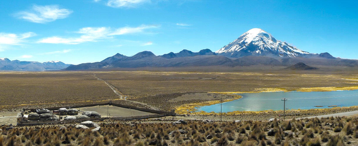
Sajama National Park owns its name to a gigantic presence that lives among the clouds and that seems serenely unaware of the noisy flocks of birds that fly through its enchanted vistas. This is the Sajama volcano, the highest and most imposing mountain peak in Bolivia rising to 6.542 m.a.s.l., and without a doubt the park’s main attraction. Its austere beauty seduces and enchants any visitor who approaches the natural marvel.
In order to protect one of nature’s privileged children, the Bolivian State decided to protect the area by creating a national park in 1939, with an area of 100.223 hectares, located in the Sajama Province of the Oruro Department.
Its natural and cultural treasures make this area one of Bolivia’s most important conservation scenarios, since it has a large expanse of queñua forests, made up of trees that grow to the highest altitude in the world (up to 5200 meters), and which lodge several endangered species of birds.
The people in the Park live in two small towns called Sajama and Caripe, located at the foot of the mountain, and in numerous small ranches whose cattle ranges over communal lands.
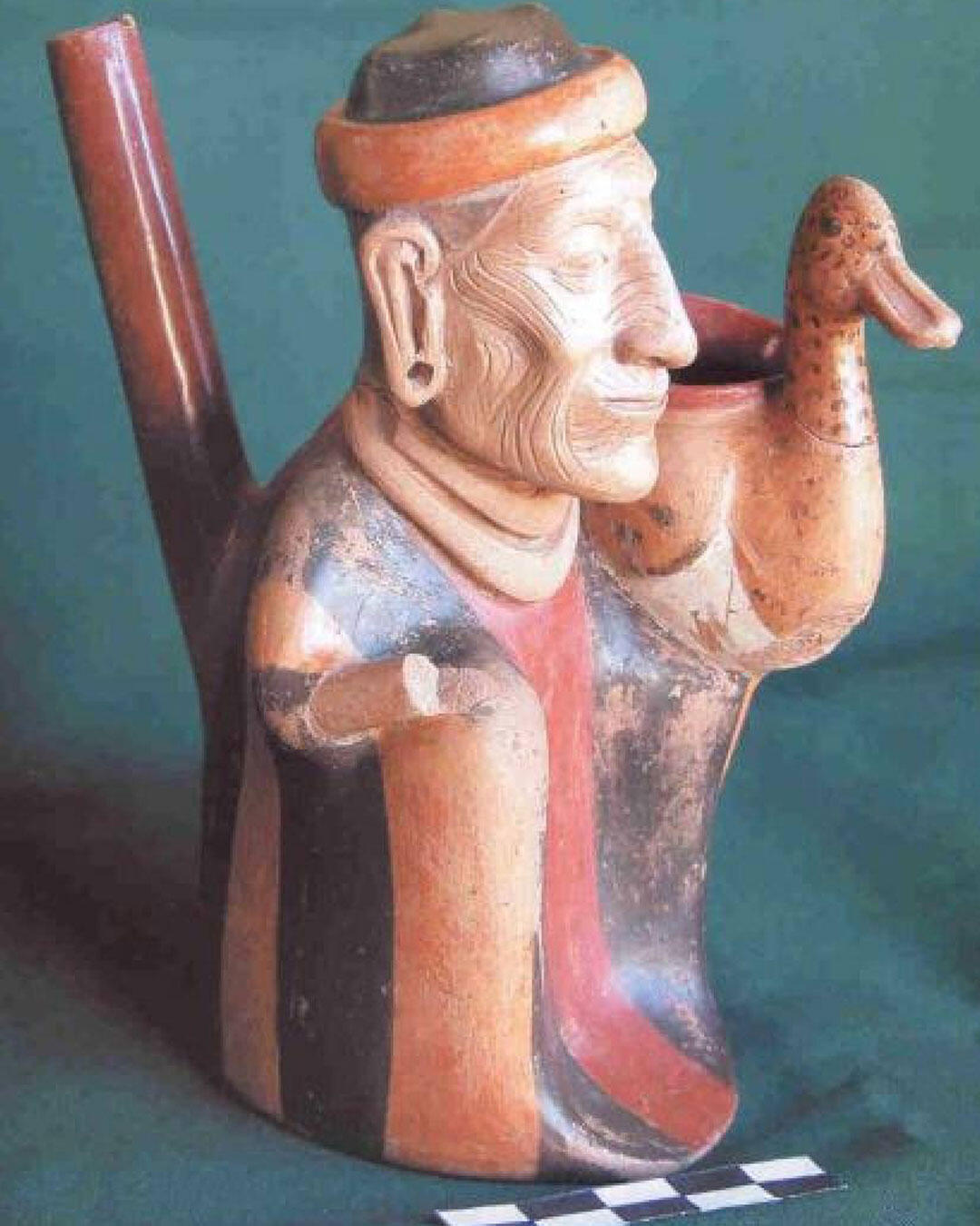
Pariti houses a museum with fine ceramic pieces from Tiwanaku culture. The most representative piece is called El Señor de los Patos (the Lord of the Ducks) which is known for its perfection and artistic quality compared with pieces of the Roman Empire or creations of Leonardo Da Vinci.
The tour begins in the town of Huatajata, after a 2-hour trip from the city of La Paz, from Huatajata we board a local boat to travel for 1 hour through the "Lago Menor" that takes part of the Lake Titicaca. Arrival to the Pariti Island and visit to the local museum.
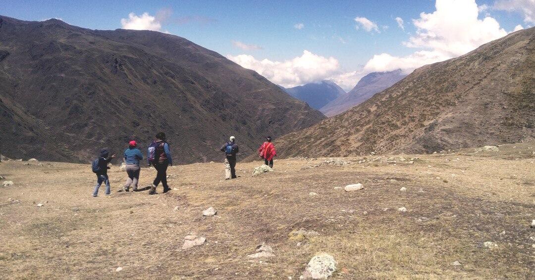
Pacha Trek is a tourist product that offers the traveler a different experience, with pleasant walks and stays in traditional communities that take part of the product "Walking with Kallawayas", traversing mystical Andean regions with local guides who are happy to explain their Aymara and Quechua cultures. This trek directly involves three communities in the Apolobamba area. The product is sold by travel agencies with transportation by private car from La Paz and from Charazani to La Paz. They include an overnight stay in communities: Qutapampa, Kaluyo and Chacapari. There is also the possibility of taking a bus to Pelechuco and staying in Qutapampa to begin the trek there and end it in Charazani, where one can take a bus back to La Paz.
This tour implies trekking though high-altitude paths, and overnights in three different lodges at over 4000 m.a.s.l., but undoubtedly it is the product that brings the tourist closest to the life of the communities, above all the high-altitude herding raised. These lodges are very basic. A sleeping bag is suggested, and though meals are included in the package, it is recommended to bring adequate food supplements.
WHAT IS THE KALLAWAYA CULTURE?
It is an ethnic group from Bolivia that practices ancestral medicine with local rites and ceremonies, recognized by UNESCO as Oral and Intangible Heritage of Humanity.
APOLOBAMBA
The Apolobamba Natural Integrated Management Area covers about 483.743 hectares. It is located northwest of the La Paz department, and constitutes a mosaic of discrete units that include representative samples of eco-regions, indigenous communities and important flora and fauna species.
Apolobamba was created for the purpose of protecting high Andean ecosystems and one of the largest vicuña populations in the country. Its scenery is characterized by long sharp gradients that comprise high Andean humid semi-tropical mountain landscapes. The area forms part of the bi-national Vilcabamba-Amboró corridor, considerated to be the most diverse hotspot in the world.
Over 800 plant species have been recorded, with estimates that these could come to 1800 incorporating probable species in unrecorded sites. As for vertebrate species, 296 have been recorded, among which are several endangered species such as the vicuña, the small jucumari lensed bear and other endemic species that inhabit the protected area.
ULLA ULLA NATIONAL RESERVE
The Apolobamba Mountain Range contains the Ulla-Ulla National Reserve. From the Reserve, one can frequently see condors, one of the most impressive birds in the world. Its abundant vegetation lodges llamas, alpacas, guanacos and the largest vicuña population in Bolivia. The tourist can also find other wild species such as puma, taruca, Andean bear, ducks and deer, among others.
Over 12.000 people in 35 communities, of Aymara descent, inhabit the area. They keep their ancestral customs and traditions and devote themselves mainly to the raising of camelids (llama and alpaca) as well as sheep.
Finally, the Reserve offers endless possibilities for ecotourism and various adventure activities such as sport fishing, mountaineering, trekking and others.
To reach this destination one must traverse approximately 360 kilometers and undoubtedly, the best way of doing this is in a private four-wheel drive, all-terrain vehicle.
The trip, at a reasonable speed, takes about seven hours, without taking into account the innumerable photo-taking stops that become necessary along the way. From La Paz, one takes the Lake Titikaka highway. Upon reaching Huarina, one takes the road to Achacachi and goes past it, going through Ancoraimes and Carabuco, up to Escoma (km 190), until the end of the asphalt road.
One the way, one must necessarily visit the Carabuco Church, which is covered by some of the most important fresco paintings in South America. This church was built by the Indian price of the area, the Siñani, chieftain whose descendants still play an important role in today’s Bolivian politics.
Sampaya gives the visitor the unique opportunity of sharing and interacting with an indigenous Andean community. Through its Visitor’s Center and its two trekking path guided by local experts, this community offers the possibility of understanding the Aymara cosmo vision, of sharing ancient rites and traditions and experiencing the life of the community.
This is one of the most authentic and picturesque towns in the Copacabana peninsula, because it has preserved its ancestral architectural and construction techniques in stone. From the town’s hillsides one can appreciate the immensity of the lake, the Isla de la Luna and the Cordillera Real, especially the massif made up of the Illampu and peaks. This idyllic setting has the advantage of being very close to Copacabana, no more than 12 km away, and of being accessed by a good all-weather road.
Whoever visits Sampaya can do it on foot through the Copacabana – Yapupata route, a road that goes largely along the shores of the lake, and takes about three hours to walk. This trek will allow the visitor to become used to the Altiplano region altitudes, while observing beautiful lakeside vistas.
Additionally, this community-owned enterprise has a small lodge that can house up to eight people with all comfort, a restaurant for 24 people and a handicrafts center.
The visitor can choose between tours of one or two days. Sampaya can be a fantastic alternative for those who seek a cultural and life-style experience with Lake Titikaka communities.